
The Important Role that GIS Plays in Archaeology
The Important Role that GIS Plays in Archaeology and Cultural Resource Management
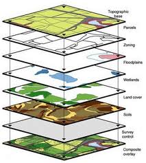
The use of geographic information systems (GIS) in archaeology and cultural resource management has grown exponentially over the last 10 years. Not only does GIS technology play a very important role in managing critical data, it also supports significant archaeological digs while preserving history.
“Maps have always been an essential tool of archaeology, but now technology is helping archaeologists invent new ways of collecting, analyzing, managing and communicating their data using GIS,” says Dr. Cancilla.
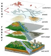
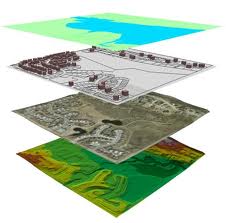
GIS computerized tools used to collect, archive, manage, retrieve, analyze and output geographic and other related kinds of data offer great potential to be a powerful tool for cultural resource management specialists.
“GIS allows them [archaeologists] to know where things are and to connect better to a database on the back end of the artifact that they’re pulling out of the ground,” says Dickinson. “It’s all about gathering the data in a geo-referenced way that you can then put into a database and find out more things about the data that you’ve been collecting.”