
Spotting ancient sites, from space
Spotting ancient sites, from space
Harvard archaeologist uses computers and satellite images to search for early human settlements
Harvard University
Source - http://www.eurekalert.org/pub_releases/2012-03/hu-sas031612.php
A Harvard archaeologist has dramatically simplified the process of finding early human settlements by using computers to scour satellite images for the tell-tale clues of human habitation, and in the process uncovered thousands of new sites that might reveal clues to the earliest complex human societies.
As described in a paper published March 19 in the Proceedings of the National Academy of Sciences, Jason Ur, the John L. Loeb Associate Professor of the Social Sciences, worked with Bjoern Menze, a research affiliate in MIT's Computer Science and Artificial Intelligence Laboratory to develop a system that identified settlements based on a series of factors – including soil discolorations and the distinctive mounding that results from the collapse of mud-brick settlements.
Armed with that profile, Ur used a computer to examine satellite images of a 23,000 square-kilometer area of north-eastern Syria, and turned up approximately 9,000 possible settlements, an increase of "at least an order of magnitude" over what had previously been identified.
"I could do this on the ground," Ur said, of the results of the computer-aided survey. "But it would probably take me the rest of my life to survey an area this size. With these computer science techniques, however, we can immediately come up with an enormous map which is methodologically very interesting, but which also shows the staggering amount of human occupation over the last 7,000 or 8,000 years.
"What's more, anyone who comes back to this area for any future survey would already know where to go," he continued. "There's no need to do this sort of initial reconnaissance to find sites. This allows you to do targeted work, so it maximizes the time we have on the ground."
Satellites expose 8,000 years of civilization
Archaeologists develop large-scale method to identify ancient human settlements.
Virginia Gewin
Source - http://www.nature.com/news/satellites-expose-8-000-years-of-civilization-1.10257
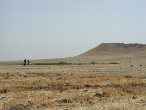
Mounds of earth covering ancient human settlements, such as Tell Brak in northeastern Syria, can now be analysed remotely using satellite imagery. JASON UR
Hidden in the landscape of the fertile crescent of the Middle East, scientists say, lurk overlooked networks of small settlements that hold vital clues to ancient civilizations.
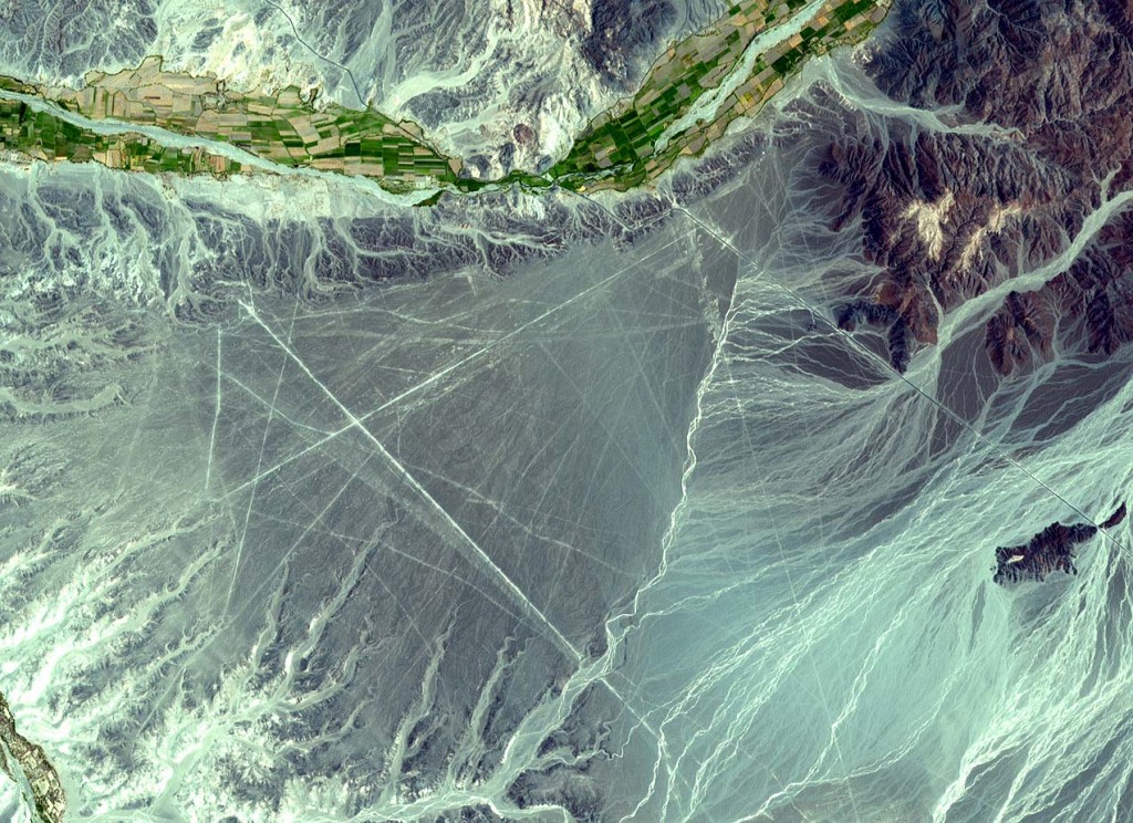
Beyond the impressive mounds of earth, known as tells in Arabic, that mark lost cities, researchers have found a way to give archaeologists a broader perspective of the ancient landscape. By combining spy-satellite photos obtained in the 1960s with modern multispectral images and digital maps of Earth's surface, the researchers have created a new method for mapping large-scale patterns of human settlement. The approach, used to map some 14,000 settlement sites spanning eight millennia in 23,000 square kilometres of northeastern Syria, is published today in theProceedings of the National Academy of Sciences1.
“Traditional archaeology goes straight to the biggest features — the palaces or cities — but we tend to ignore the settlements at the other end of the social spectrum,” says Jason Ur, an archaeologist at Harvard University in Cambridge, Massachusetts, who is co-author of the study. “The people who migrated to cities came from somewhere; we have to put these people back on the map.”
Such comprehensive maps promise to uncover long-term trends in urban activity. “This kind of innovative large-scale application is what remote sensing has been promising archaeology for some years now; it will certainly help us to focus our attention on the big picture,” says Graham Philip, an archaeologist at Durham University, UK.
Soil signatures
The satellite-based method relies on the fact that human activity leaves a distinctive signature on the soil, called anthrosols. Formed from organic waste and decayed mud-brick architecture, anthrosols are imbued with higher levels of organic matter and have a finer texture and lighter appearance than undisturbed soil — resulting in reflective properties that can be seen by satellites.
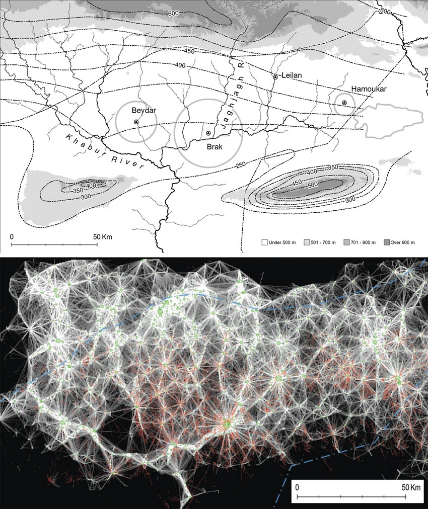
Analysis of the locations of ancient settlements can reveal the many connections between them. FROM REF 1
To sift through satellite images for those signatures, co-author Bjoern Menze, a research affiliate in computer science at the Massachusetts Institute of Technology in Cambridge, built on his skills from his day job identifying tumours in clinical images.
Menze trained software to detect the characteristic wavelengths of known anthrosols in images spanning 50 years of seasonal differences. This automation was key. “You could do this with the naked eye using Google Earth to look for sites, but this method takes the subjectivity out of it by defining spectral characteristics that bounce off of archaeological sites,” says Ur.
Menze and Ur also used digital elevation data collected in 2000 by the space shuttle as part of NASA's Shuttle Radar Topography Mission (SRTM). This information enabled the authors to estimate the volume of the larger sites for the first time — and to use this volume as a proxy for a site’s longevity. The bigger the mound, the longer the settlement survived.
Tony Wilkinson, an archaeologist at Durham University and Ur’s former mentor, says that being able to measure the volume of many sites over large areas remotely is a breakthrough. However, Philip cautions that the resolution of the SRTM data may be too coarse to provide an accurate measurement for the volume of the smaller settlements. Nonetheless, he expects that the method will spark new archaeological insights for several different regions.
New life for old hypotheses
The method has already renewed speculation about the importance of water to city development. Surprisingly, this study found that a handful of sites are unexpectedly large given that they are not located near rivers or in areas of high precipitation. “The settlement known as Tell Brak, for example, is far too large for what one would expect at such a marginal position,” says Ur. “This is where things get interesting.”
Jennifer Pournelle, a landscape archaeologist at the University of South Carolina in Columbia, agrees. “These findings validate hypotheses I’ve introduced in southern Iraq — namely that irrigation is an after-effect of urbanization,” she says. “It’s not what enables a city to develop; it’s what keeps them going after soil moisture dries up.”
Pournelle says that she plans to adopt this method as soons as possible, and notes that it offers a valuable way to learn more about large regions, particularly when they are remote and difficult to access because of local conflicts.
References
- Menze, B. H. & Ur, J. A. Proc. Natl Acad. Sci. USA http://dx.doi.org/10.1073/pnas.1115472109(2012).