Lidar archaeology shines a light on hidden sites
Curt Hopkins
Source - http://www.bbc.com/future/story/20120827-the-laser-archaeologists/4
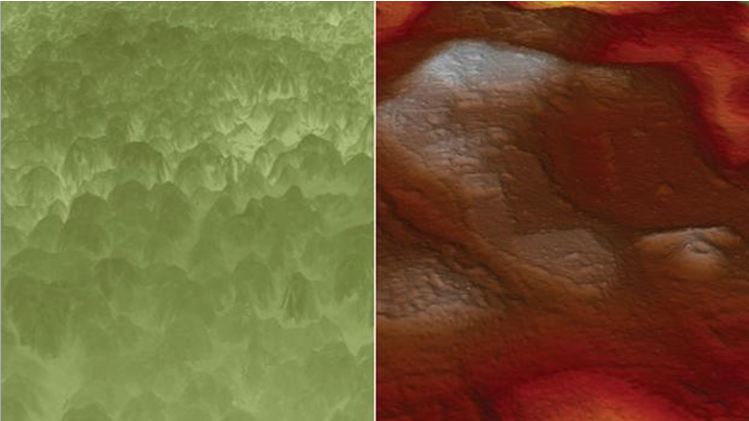
Lidar fires laser light and collects the reflection. It allows archaeologists to peer through dense vegetation obscuring sites like Angamuco in Mexico. (Copyright: C Fisher)
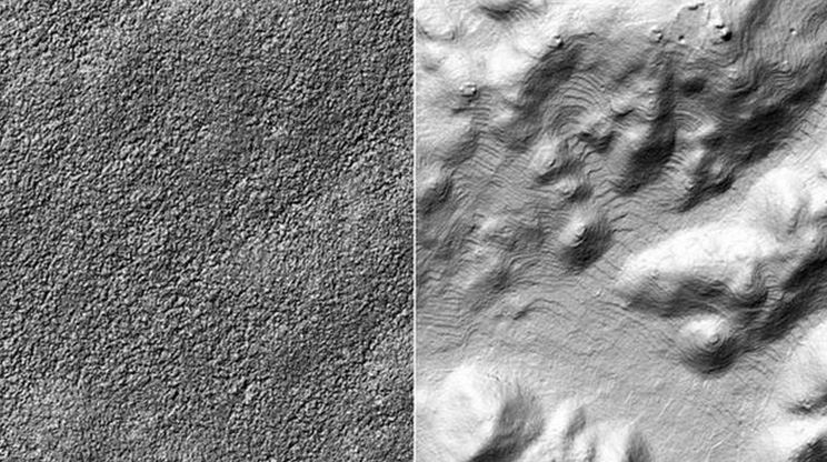
The technique has also been used on the Mayan city of Caracol, Belize, which is obscured by dense forest(right) that make traditional techniques difficult. (Copyright: A&D Chase)
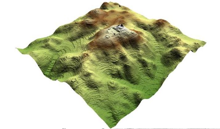
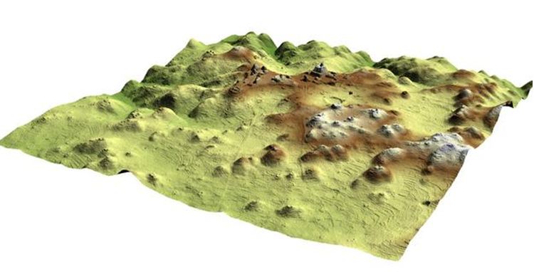
3D maps created using Lidar data allow features to be seen in fine detail, particularly large areas of agricultural terraces that once surrounded the city. (Copyright: A&DChase)
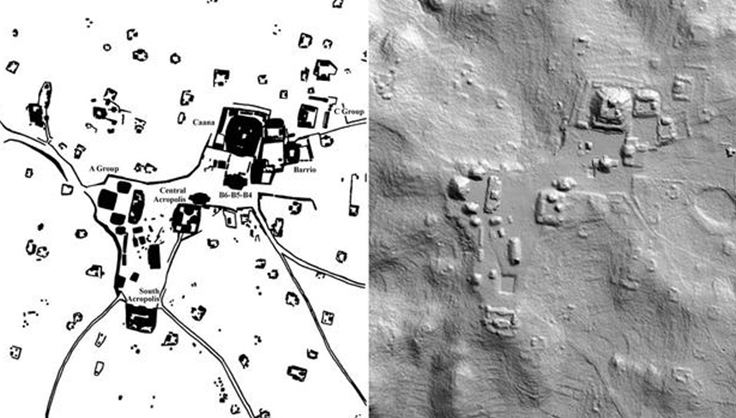
Traditional hand drawn maps can be contrasted with a 2D LiDAR imageof Caracol in which terraces, topography and other archaeological remains are visible. (Copyright: A&D Chase)
Techniques like this changed the perception of the site from a rarely-inhabited ceremonial centre to a bustling city with complex agriculture. (Copyright: A&D Chase)
If you think archaeologists spend all the time with trowel in hand in a muddy ditch then it’s time to think again. More and more are using sophisticated aircraft-mounted lasers, and it is opening up a new age of discovery.