ARCHEOLOG-HOME / INDIana-UNIversitas
Contact


Denmark’s past viewed from above
Charlotte Price Persson / Photo credits: Lis Helles Olesen and Esben Schlosser Mauritsen
Source - http://sciencenordic.com/denmark%E2%80%99s-past-viewed-above
Vestiges of remnant houses from the Early Iron Age, which stand side by side along what was once the village road. Also visible on this photo are relics of the extensions that have belonged to the farms. They are located behind the houses on the side facing away from the road. This find was named as one of the top ten finds of 2010 by the Danish Agency of Culture.
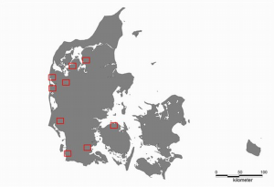
The nine areas in Denmark selected for the aerial archaeology project, which is scheduled to run until 2013.
Since 2009 archaeologists have been using small aircraft to map nine areas in Denmark that are of particular interest to archaeologists and historians.
The project is called 'The past as viewed from the sky – air archaeology in Denmark' and will initially run until 2013.
But what can aerial photos possibly tell us about the past?

Vestiges of small buried labour huts, called pit houses, from the Viking Age. All the round green spots in the field are relics of huts which have been dug a half to a full metre down into the ground. When these houses were no longer of any use, they were broken down and the hole was filled up with waste from the settlement. As a result, the corn is enjoying particularly good growing
Quite a lot, actually. When, for instance, the Vikings dug deep holes for the poles that bore their houses, it significantly altered the growth conditions on that particular piece of land.
This means that it’s still possible to spot differences in the way the grain grows on just the circle of land where the pole once stood.

An indication of how the contour and the size of the houses have changed over time. We see, for instance, a drop in the number of poles used for supporting the building. This is partly because the Vikings figured out that they could reinforce their houses by using curved walls. (Illustration from the book ‘Aerial photos of Denmark’ by Lis Helles Olesen, Henrik Dupont and Claus Dam)
This helps archaeologists determine the nature and the age of the buildings and the settlements.
“The objective of this project is to gain a clearer view of the ancient monuments in Denmark. I hope this will spark a greater interest in the past,” says archaeologist and project manager Lis Helles Olesen, who is also a curator at Holstebro Museum.
Sand is ideal for aerial archaeology
There are great differences in the kinds of soil layer that the archaeologists study from above. And that’s actually part of the reason why just these nine areas were selected: they represent all types of soil layer.
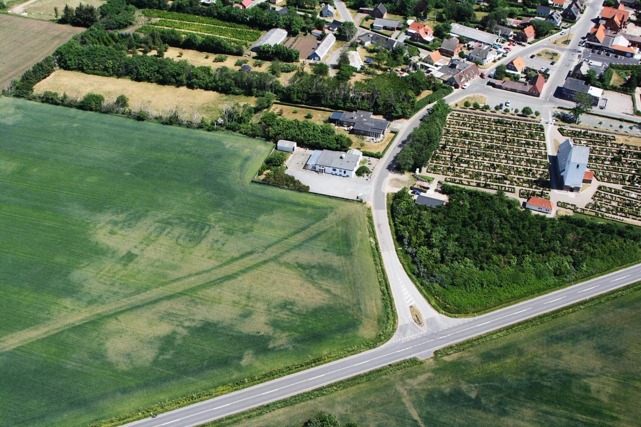
Vestiges of Iron Age remnant houses enclosed by fencing. The photo also shows traces of an abandoned road from more recent times, which has run right through the field. Many of the remnant houses have relics of fences around them. Only about five remnant houses are visible on this picture – where the field is light and dry. It’s very likely that Iron Age houses have occupied the green parts
“Sandy soil is the most suitable for studying archaeology from above,” says Olesen. “This is because growth differences in the soil layers are greater in sand than in other soil types, and that makes it easier to spot differences in the crops.”
Corn is better than grass, but grass is better than both potato and maize fields.
There may also be great differences in the appearance of the fields from year to year. During a very dry summer, archaeologists can make plenty of good, previously undiscovered finds by circling around the fields.
On a wet summer, however, the number of finds is much more limited. The corn simply grows too well, which means that growth differences in the grains are not sufficiently large for the archaeologists.

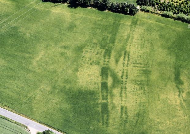
This field once housed a large Viking settlement. The centre of the picture shows vestiges of a Viking Age house with long curved walls. Other remnant houses are also visible in the cornfield, along with vestiges of pit houses.
Other factors such as humidity and light can also influence how much or how little is visible on a given day.
For that reason, archaeologists sometimes keep coming across new finds simply by flying back and forth over the same piece of field at different times.